AUSTIN, Texas – Residents across Central Texas and the Hill Country are bracing for more rain today after days of relentless deluges have triggered severe flooding, submerged roads, and prompted high-water rescues throughout the beleaguered region.
A seemingly endless pattern of thunderstorms has parked over the state since the weekend, turning creeks into raging rivers and saturating ground that can no longer absorb the moisture. The National Weather Service (NWS) extended flood watches for several counties, including Travis and Hays, through Wednesday evening, warning that even moderate additional rainfall could lead to life-threatening flash flooding.
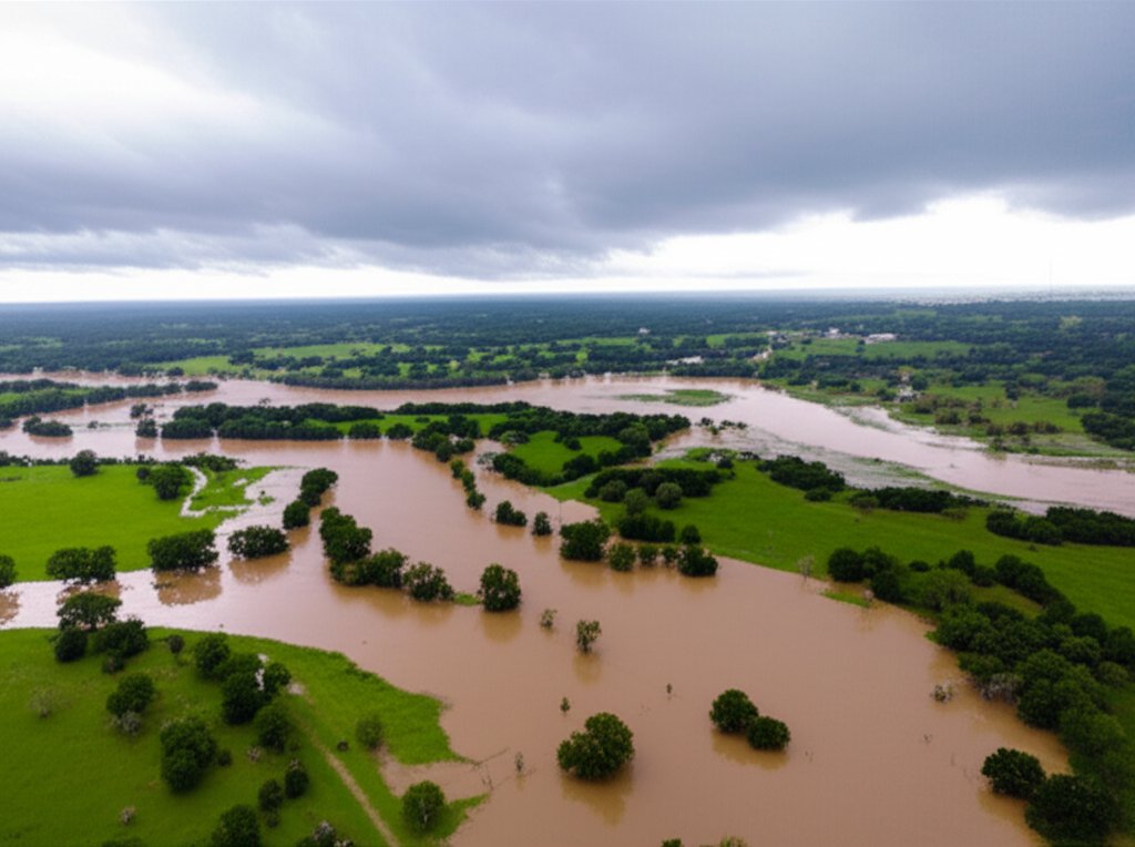
The situation escalated dramatically on Sunday and Monday, with some areas west of Austin receiving over eight inches of rain in less than 24 hours. The onslaught has overwhelmed infrastructure and put emergency services on a constant state of high alert.
A Region Under Water
The impact has been most acute in the picturesque but flood-prone Texas Hill Country. Rivers like the Pedernales and the Guadalupe, popular for recreation, have surged well past flood stage, inundating low-lying properties and forcing the closure of numerous ranch roads and county crossings.
In Travis County, Austin's emergency management officials have reported dozens of closed low-water crossings and have urged motorists to "Turn Around, Don't Drown," a public safety campaign that has become a grimly familiar refrain.
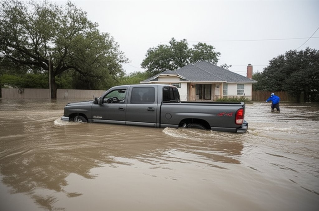
"The ground is completely saturated," said a spokesperson for the NWS Austin/San Antonio office in a briefing Tuesday. "It doesn't take much to create a dangerous situation now. An inch of rain in 30 minutes can cause significant problems on the roadways and in smaller streams."
Meteorological Culprit: A Stalled System
The persistent downpours are the result of a stalled frontal boundary interacting with a deep plume of tropical moisture streaming in from the Gulf of Mexico. This weather setup has created a "firehose" effect, repeatedly training thunderstorms over the same areas.
Unlike a fast-moving storm system, this pattern has remained stubbornly in place, with no strong upper-level winds to push it out of the region. Forecasters explain that until a significant shift in the larger atmospheric pattern occurs, such as the arrival of a strong high-pressure system, Texas will remain vulnerable to these rounds of heavy rain.
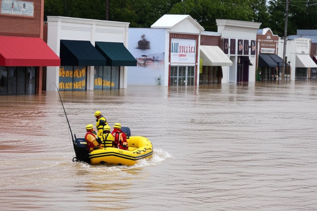
The Texas Division of Emergency Management (TDEM) has coordinated with local jurisdictions to preposition swift-water rescue teams and other resources in high-risk areas. Officials have been monitoring dam and reservoir levels, though major metropolitan water supplies are not currently threatened. The primary concern remains flash flooding from intense, localized rainfall.
When Will the Rains End?
The question on every Texan's mind is when a reprieve will arrive. According to the latest NWS forecasts, the answer offers little immediate comfort.
Showers and thunderstorms remain in the forecast for Central Texas through Thursday. While the coverage and intensity may wax and wane, the threat of heavy downpours will persist. Meteorologists are cautiously optimistic that the stalled front may begin to weaken and drift south by Friday, potentially allowing a ridge of high pressure to build over the state this weekend.
If that pattern holds, residents could finally see a transition to a more typical hot and dry Texas summer weather pattern by early next week. Until then, officials are pleading with the public to remain vigilant, monitor local news and weather alerts, and have an evacuation plan ready.
"We are not out of the woods yet," warned a TDEM statement on Wednesday. "The threat is real, and it will continue for at least another 48 hours."