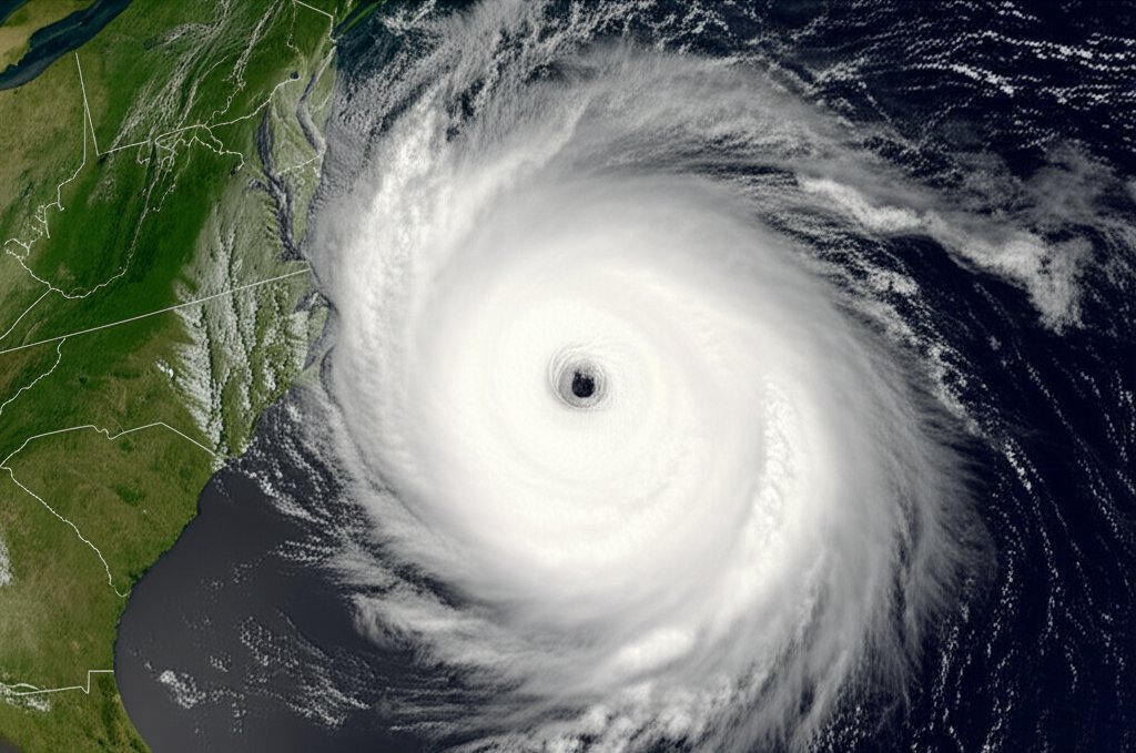
WASHINGTON – Coastal communities along the U.S. Atlantic seaboard are on high alert as Hurricane Erin, a sprawling and slow-moving system, continues its westward track, threatening to deliver a devastating blow of storm surge and prolonged rainfall from North Carolina to the Mid-Atlantic.
In its latest advisory on Thursday, the National Hurricane Center (NHC) in Miami placed a hurricane warning in effect for a significant stretch of the North Carolina coastline, including the entire Outer Banks. States of emergency have been declared in coastal counties in both North Carolina and Virginia as residents face mandatory evacuation orders.
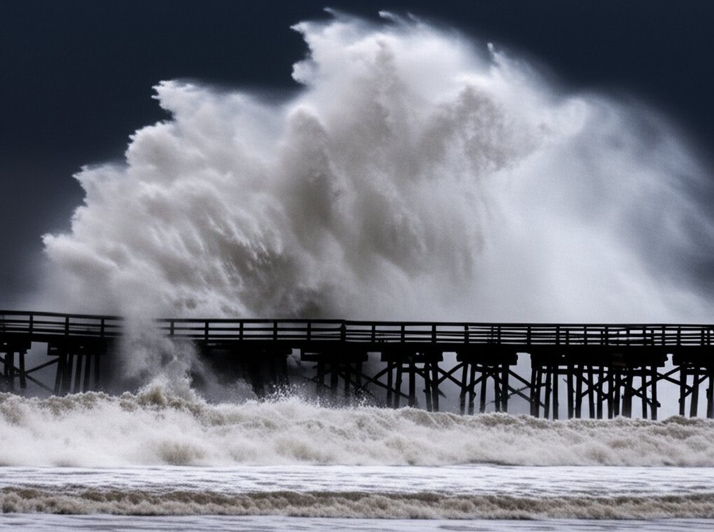
While currently a Category 2 storm with sustained winds of 105 mph, forecasters are urgently warning the public not to focus on the wind speed alone. Erin's immense size is its most dangerous feature, extending tropical-storm-force winds outward up to 200 miles from its center. This vast wind field is pushing a massive volume of ocean water toward the coast, setting the stage for what the NHC calls a "life-threatening storm surge" of up to 9 feet in some areas.
The Threat of Water, Not Just Wind
"This is a water event more than a wind event," said Dr. Michael Brennan, Director of the National Hurricane Center, in a morning briefing. "A storm of this size and slow forward speed can produce catastrophic flooding, beach erosion, and dangerous rip currents for hundreds of miles, well beyond the center of the storm."
The storm’s slow-moving nature, currently crawling at just 8 mph, exacerbates the threat. It allows the hurricane to linger over the region, dumping potentially historic amounts of rain—up to 20 inches in isolated areas—and prolonging the onshore wind assault that builds up the storm surge.
Officials are particularly concerned about the low-lying Outer Banks of North Carolina, where mandatory evacuations for residents and tourists in Dare and Hyde counties have been in effect since Wednesday. Traffic was heavy on routes leading inland as people heeded the warnings.
"We cannot stress this enough: get out now," said North Carolina Governor Roy Cooper. "First responders will not be able to reach you once storm conditions intensify. Your life is more valuable than your property."
Preparations and Regional Impact
Further north, Virginia has declared a state of emergency, with naval ships based in Norfolk being moved out to sea to ride out the storm. Residents in coastal areas like Virginia Beach are filling sandbags and securing property, preparing for significant tidal flooding expected to inundate streets and homes.
The storm is already making its presence felt. Large, powerful swells generated by Erin are creating dangerous surf and life-threatening rip currents along beaches from Florida to New England. Several coastal towns have closed their beaches to swimmers, and the U.S. Coast Guard has issued advisories for all mariners to remain in port.
The forecast track from the NHC remains uncertain, with a slight westward wobble potentially bringing the storm's core ashore in North Carolina late Friday or early Saturday. However, even if the eye of the storm remains just offshore, its immense size ensures a significant and damaging impact across a wide coastal area.
Federal emergency agencies have pre-positioned assets, including water, food, and response teams, just outside the projected impact zone to be able to move in and provide assistance as soon as conditions allow. Residents in the storm's path are urged to finalize their preparations and monitor updates from local officials and the National Hurricane Center closely.