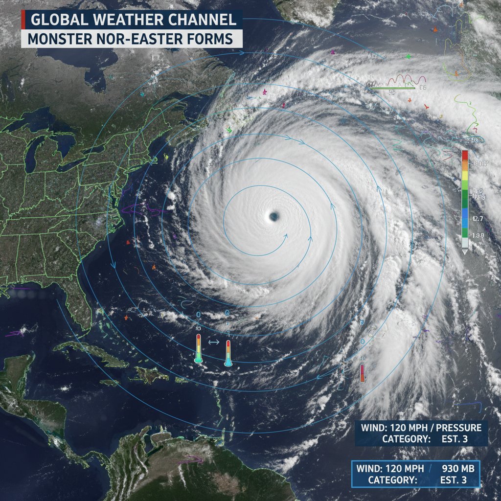
A powerful and rapidly intensifying nor’easter has begun its trek up the U.S. East Coast this Sunday morning, threatening to blanket the densely populated corridor from Washington, D.C., to Boston in significant snowfall. Meteorologists from the National Weather Service (NWS) have issued winter storm warnings for over 30 million residents, as a low-pressure system undergoes "bombogenesis"—a process of rapid intensification—just off the Mid-Atlantic coast.
The storm arrives following a period of relatively mild winter temperatures, catching some residents off guard. However, emergency management agencies have spent the last 48 hours pre-positioning equipment and personnel to handle what is expected to be the most significant winter event of the 2025-2026 season for many metropolitan areas.
A Perfect Meteorological Storm
The current system is the result of a classic winter setup: a sharp dip in the jet stream has allowed frigid Canadian air to collide with moisture-rich air over the Gulf Stream. As the storm tracks northeast, it is expected to hug the coastline, a path that typically maximizes snowfall totals for major urban centers.
Meteorologists report that the central pressure of the storm is dropping at a rate that qualifies it as a "weather bomb." This sudden intensification is driving high wind gusts, which are expected to reach 50 to 60 mph in coastal areas of New Jersey, Long Island, and New England. These winds, combined with heavy, wet snow, raise the risk of widespread power outages due to downed trees and utility lines.
Regional Breakdown and Forecasted Totals
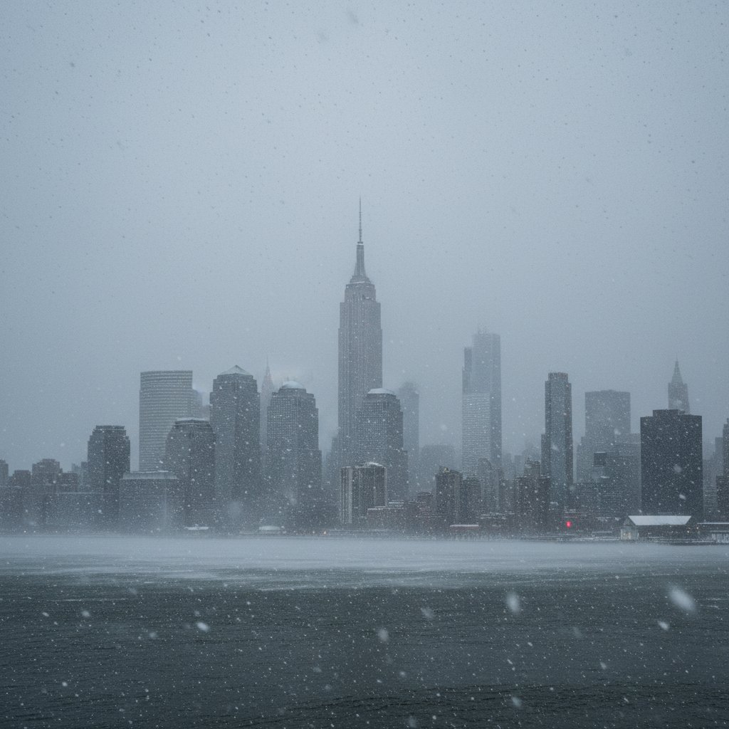
The impact of the storm varies significantly by latitude and distance from the coast. In the nation's capital and Baltimore, the storm began as a cold rain before transitioning to a heavy, slushy snow early Sunday morning. Further north, Philadelphia and New York City are bracing for a more prolonged period of heavy snowfall, with rates potentially reaching two inches per hour during the peak of the storm.
The following table outlines the current projected impacts for major cities along the Interstate 95 corridor:
| City | Expected Snowfall | Peak Wind Gusts | Primary Threat |
|---|---|---|---|
| Washington D.C. | 2–5 inches | 35 mph | Slushy roads, low visibility |
| Philadelphia | 6–10 inches | 45 mph | Heavy snow, travel delays |
| New York City | 8–14 inches | 50 mph | Near-blizzard conditions |
| Boston | 12–18 inches | 60 mph | Coastal flooding, power outages |
In New England, the storm is expected to linger well into Monday morning. The Massachusetts Emergency Management Agency has warned residents of the potential for coastal flooding during the Sunday evening high tide, particularly in north-facing shorelines where surge levels could reach two to three feet above normal.

Infrastructure and Travel Disruptions
The transportation sector is currently facing severe logistical challenges. According to the Federal Aviation Administration (FAA), over 2,500 flights have already been canceled across major hubs including Reagan National, Philadelphia International, and Newark Liberty. Major airlines have issued travel waivers, urging passengers to rebook rather than venture to the airports.
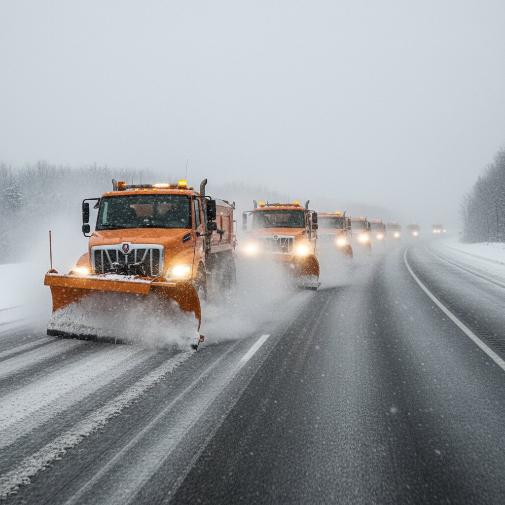
On the ground, Amtrak has modified its Northeast Regional and Acela schedules, canceling several midday departures to ensure the safety of passengers and crew. State Departments of Transportation have deployed thousands of salt trucks and plows, but officials warn that if snowfall rates exceed one inch per hour, road crews will struggle to keep lanes clear.
Governors in New York and New Jersey have declared states of emergency, a move that allows for more flexible deployment of National Guard resources and facilitates mutual aid between municipalities. Residents are being strongly advised to stay off the roads to allow emergency vehicles and snow removal equipment to operate unimpeded.

Public Safety and Preparedness
As the storm reaches its peak intensity, public health officials are reminding residents of the dangers associated with heavy snow removal. Heart attacks during shoveling are a leading cause of storm-related fatalities. Experts recommend taking frequent breaks and pushing snow rather than lifting it whenever possible.
Utility companies like Con Edison and Dominion Energy have placed thousands of line workers on standby. However, they caution that if wind speeds exceed 35 mph, it may be unsafe for crews to use bucket trucks to repair lines, potentially leading to prolonged outages in some suburban and rural areas.
Residents are urged to maintain a "go-bag" with essential supplies, including flashlights, batteries, and non-perishable food. With temperatures expected to plunge into the low 20s behind the storm front, the risk of flash freezing on untreated surfaces will remain a concern through Monday morning's commute.