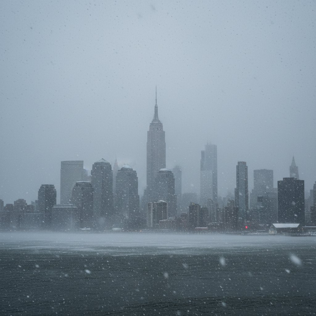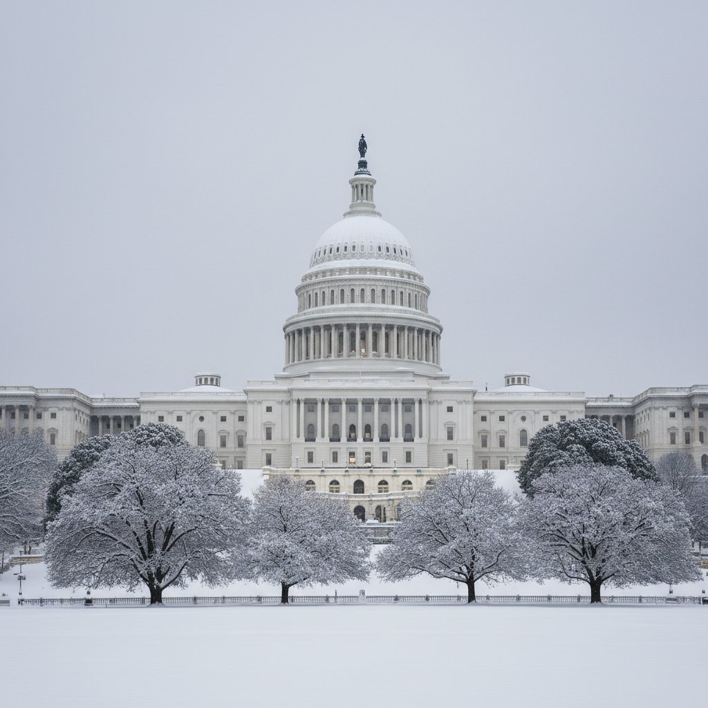
The Washington D.C. metropolitan area is grappling with the aftermath of a powerful coastal storm that intensified overnight, leaving a thick blanket of snow and slush across the region. As of Monday morning, February 23, 2026, federal offices and hundreds of school districts have announced closures or shifted to remote operations as local authorities struggle to clear primary and secondary roadways.
The storm, which began as a cold rain early Sunday morning, transitioned into a heavy, wet snow late Sunday evening. This transition, fueled by a rapidly deepening low-pressure system off the Virginia Capes, created treacherous conditions during the overnight hours. Meteorologists from the National Weather Service (NWS) report that snowfall totals have reached between five and nine inches in the immediate D.C. suburbs, with higher amounts recorded in the foothills of the Blue Ridge Mountains.
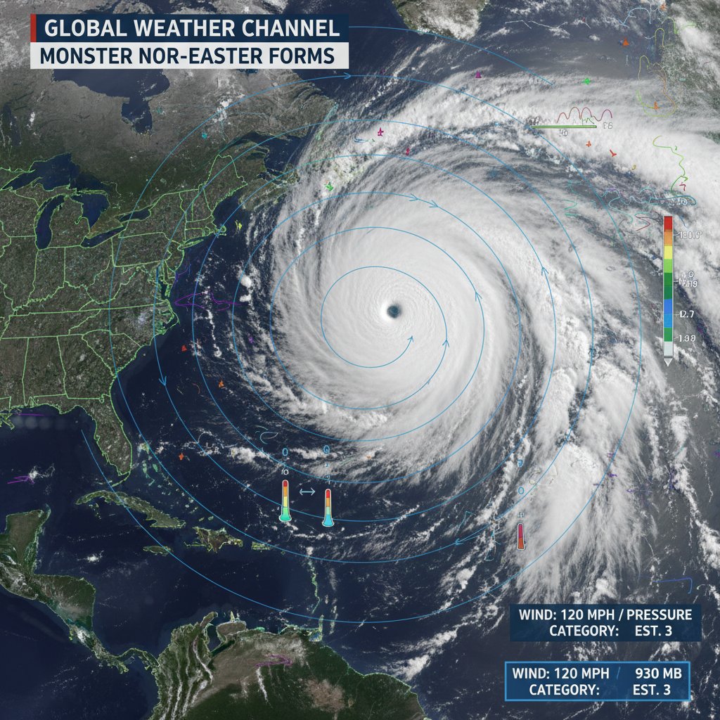
A Rapidly Intensifying System
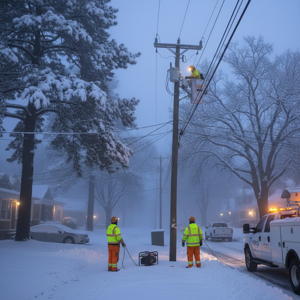
This weather event, characterized by meteorologists as a classic Nor'easter, brought not only precipitation but also sustained winds of 25 to 35 mph, with gusts reaching up to 50 mph near the Chesapeake Bay. The combination of heavy, moisture-laden snow and high wind speeds has placed significant stress on the region’s power grid.

According to utility trackers, approximately 45,000 customers across Northern Virginia and Maryland are currently without power. Utility crews were prepositioned ahead of the storm, but high winds have hampered efforts to use bucket trucks for line repairs in the early morning hours.
"This storm had a very efficient cooling mechanism," explained Dr. Elena Vance, a senior meteorologist. "The rapid intensification of the low-pressure system pulled in just enough cold air from the north to flip the rain over to snow much faster than many models predicted on Saturday. The result is this heavy 'heart-attack' snow that is particularly difficult to plow and dangerous for trees."
Transport and Infrastructure Impact
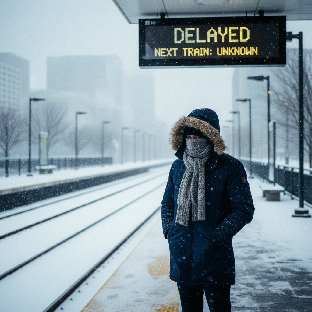
The Monday morning commute has been largely non-existent for many, though essential workers face difficult journeys. Reagan National and Dulles International Airports have reported over 400 cancellations combined. While runways are being treated, the visibility issues caused by blowing snow forced a temporary ground stop earlier this morning.
The Washington Metropolitan Area Transit Authority (WMATA) has suspended bus service on several hilly routes and is operating Metrorail on a weekend schedule. Commuter rail services, including VRE and MARC, have canceled most morning inbound trips to allow for track inspections and snow removal.
| Location | Snowfall Estimate (Inches) | Peak Wind Gust (MPH) |
|---|---|---|
| Washington, D.C. (National Mall) | 5.2 | 42 |
| Arlington, VA | 6.1 | 39 |
| Bethesda, MD | 7.5 | 35 |
| Dulles Int'l Airport | 8.8 | 46 |
Regional Response and Safety
The Office of Personnel Management (OPM) announced early this morning that federal offices in the D.C. area are closed to the public, with emergency employees expected to report for work and telework-ready employees expected to remain productive from home. This "Maximum Telework" posture has become the standard response for the region following the infrastructure lessons of the late 2010s.
Local emergency management agencies are urging residents to stay off the roads to allow snowplows to operate effectively. In a press briefing at 7:00 AM, District officials noted that while temperatures are expected to hover near freezing today, a secondary "clipper" system could bring additional light snow showers tonight, potentially complicating the Tuesday morning commute.
"Our primary concern is the refreezing of wet surfaces as we head into tonight," said a spokesperson for the D.C. Department of Public Works. "What looks like slush now will become solid ice by sunset. We are asking for patience as we move from the major corridors into the residential neighborhoods."
Context: A Season of Extremes
This storm follows a period of unseasonably warm weather that had seen the last remnants of January's ice melt away just last week. The sudden return to wintry conditions has disrupted the early budding of local flora, including the famous cherry blossoms, though arborists suggest it may be too early in the season for permanent damage to the trees.
For many residents, the storm represents a final wintry blast in a season that has been defined by its volatility. Climate scientists point to the increasing frequency of these "rapid-deepening" coastal storms as a byproduct of warmer-than-average Atlantic sea-surface temperatures providing additional energy to the atmosphere.
Frequently Asked Questions
Is the Metro running today? Yes, but on a limited weekend schedule. Some outdoor sections of the Red, Orange, and Silver lines may experience delays due to snow clearing on the third rail.
When will the snow stop? The main body of the storm has moved offshore, but intermittent snow showers are expected through Monday afternoon, with clearing skies by Tuesday morning.
Are schools closed tomorrow? Decisions regarding Tuesday classes are typically made by 6:00 PM on Monday. Residents are advised to monitor local school district websites.